
Every member of our Geophysical team has training from industry leaders, especially important in a field which has no standards or certifications. Each of our locators come fully equipped to every job site with the equipment below. No one piece of equipment can do the job, and Coastal brings the entire technology toolbox to solve unique problems every time.
What sounds better to you: us finding an Electrical Duct Bank or Natural Gas line with non-destructive methods, or your operator or laborer finding it at the end of a shovel? A utility is struck every 62 seconds, so let us make your site a success story and not a news story. Learn about our technology below.
Ground Penetrating Radar (GPR)
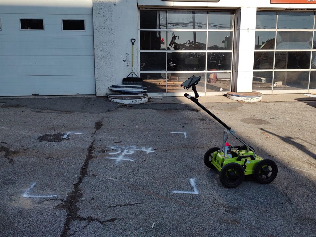
Ground Penetrating RADAR (GPR) is a non-destructive geophysical method that produces a continuous cross-sectional profile of subsurface features in real time. Practical application of GPR investigations include detecting utilities, buried Underground Storage Tanks (USTs), and other subsurface anomalies such as voids. As it is non-invasive, GPR is typically the best option to achieve a profile of your site without or prior to breaking ground.
Coastal utilizes the latest in GPR technology with the ImpulseRadar PinPointR. This Ultra Wide Band system utilizes a dual band 400/800 MHz HS antenna mounted to a stroller frame which rolls over the surface. Its compact frame allows the PinPointR to get into places larger scanning units cannot. And, the dual band allows the operator to view both a high-resolution short-range scan with the lower-resolution long-range data side by side in one pass.
Electromagnetic Antenna and Receiver (EM)
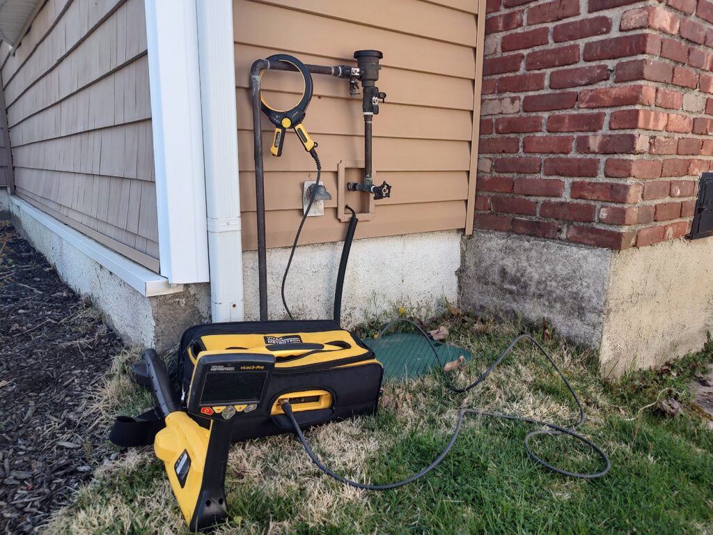
Coastal utilizes the Vivax-Metrotech vLoc3-Pro Receiver/Transmitter system to detect additional subsurface features. The EM antenna can detect pipes and cables in the ground at depths of up to 20 feet using active or passive tracing techniques. Passive tracing is the act of locating an underground utility through the detection of electrical or radio signals travelling along conductive utilities. Active tracing is used in conjunction with the Transmitter that is directly connected to the target utility or to a conductive rodder within a non-conductive line.
Magnetometer
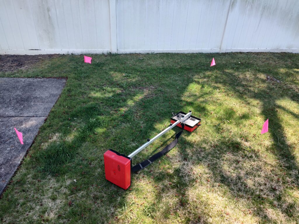
Coastal utilizes the Fisher TW-6 Magnetometer to detect buried metallic objects. This is used in conjunction with our GPR and EM antennas, and is critical in locating buried metallic USTs. This piece of technology can also be used to detect subsurface features such as large diameter conductive pipes and buried manholes, especially in areas in which traditional GPR methods cannot be utilized, such as overgrown or uneven surfaces.
Mapping and Reporting Services
Coastal provides permanent records of our Geophysical Investigations upon request. We offer formal reports to provide a detailed explanation of our equipment and methodology, detailed analysis of GPR data, and an explanation of our findings for each site. Also included in the formal reports are photos and a GPS collected map for most outdoor projects. Check out examples of the deliverables below and let our Geophysical team know about your needs.
How can we hit less Utilities?
Next Steps…
Feel free to reach out to us for any questions, quotes, or scheduling!